
How RTK GPS Works in Robot Lawn Mowers (Tech Explained Simply + Real-World Examples)
Aaron Cooper1. Introduction
If you’ve ever watched a robot mower zigzag randomly and still miss patches, you’ve felt the limits of old-school navigation. Traditional GPS simply isn’t precise enough—it can be off by several meters, which is the difference between mowing your lawn… and drifting into your flower bed.
RTK GPS changes everything. By boosting positioning accuracy from meters down to centimeters, it turns robotic mowing from “good enough” into razor-sharp precision. In this guide, we’ll break down how RTK actually works, what’s happening under the hood, and why it delivers those clean, perfectly parallel lawn stripes—plus where it can still struggle.
2. RTK GPS Basics: From Satellites to Centimeter Accuracy

2.1 How GNSS Satellites Determine Position (and Why Standard GPS Falls Short)
At its core, GPS (or more accurately, GNSS—Global Navigation Satellite Systems) works like a cosmic game of triangulation. Satellites orbiting Earth constantly send out signals with timestamps. Your mower receives signals from at least four of them and calculates how long each signal took to arrive. From that, it estimates distance—and ultimately, its position.
Sounds simple, right? Here’s the catch.
Imagine trying to mow a clean border when your “location” could shift the width of a driveway at any moment. That’s why early robot mowers relied on buried wires instead of GPS. Without precision, they simply couldn’t trust their own position.
2.2 What Makes RTK Different: Carrier-Phase Measurement Explained Simply
RTK takes that same satellite system—and upgrades how distance is measured.
Standard GPS uses something called “pseudorange,” which is basically timing how long a signal travels. It’s fast, but not very precise. RTK goes deeper by analyzing the carrier wave of the signal—the actual radio wave oscillations underneath.
RTK measures distance like counting the tiny ripples in a wave, compared to standard GPS which is like counting seconds on a stopwatch.
Each wave cycle is incredibly small. By counting those cycles (and solving a tricky math problem called “integer ambiguity”), RTK can pinpoint position with extreme precision.
This is why industry analysis consistently shows RTK achieving centimeter-level positioning using carrier-phase measurements—something standard GPS simply cannot match.
The result? Your mower doesn’t just know it’s “near the edge.” It knows it’s exactly a few centimeters away.
2.3 Accuracy Leap: From ‘Two Cars Wide’ to ‘Fingernail Precision’
Let’s translate all that tech into something you can feel.
| Technology | Estimated Margin of Error |
|---|---|
| Standard GPS | 2–5 Meters (Two cars parked end-to-end) |
| RTK GPS | 1–3 Centimeters (The size of a fingernail) |
With meter-level accuracy, a robot mower hesitates. It overlaps paths, misses strips, and avoids edges just to stay safe. That’s why older models looked random and inefficient.
With centimeter-level accuracy, everything changes:
- Straight, parallel mowing lines
- Clean edges along driveways and garden beds
- No missed patches, no wasted overlap
It’s the difference between “roughly trimmed” and “professionally maintained.” And once you see those crisp lawn stripes forming automatically? Yeah… there’s no going back.
3. The RTK System Inside a Robot Lawn Mower

3.1 Base Station vs Rover: Who Does What?
An RTK system isn’t just satellites—it’s a team effort between two devices:
- Base Station: Fixed in your yard; acts as the “truth teller.”
- Rover: The mower itself; constantly moving and receiving corrections.
The base station sits in a known, fixed position and continuously receives satellite signals. Since it already knows exactly where it is, it can detect errors in those signals—like atmospheric delays or reflections. The mower (rover) receives the same satellite signals—but it doesn’t know what’s wrong with them.
3.2 Real-Time Corrections: How Errors Get Cancelled Instantly
Here’s where the magic happens. Every second (often multiple times per second), this loop runs:
- The base station receives satellite signals.
- It compares “calculated position” vs “actual known position.”
- It determines the error for each satellite.
- It sends those corrections to the mower.
- The mower adjusts its own calculations instantly.
This process cancels out major sources of GPS error, including atmospheric delays, satellite clock inaccuracies, and signal reflections. Because the base and mower are close together, they experience nearly identical errors. So when the base corrects them, the mower benefits immediately.
3.3 What Happens Every Second While Your Mower Is Running
Now imagine what your mower is actually doing while it quietly glides across your yard. Every moment, it’s running a rapid loop:
- Receive signals from multiple satellites
- Receive correction data from the base station
- Calculate its exact position (down to centimeters)
- Compare that position to your lawn map
- Adjust steering, speed, and direction
All of this happens in milliseconds. So when your mower approaches a virtual boundary, it doesn’t “guess” where to turn. It calculates: “I’m exactly 2 cm from the edge—turn now.”
That’s how you get those crisp edges and perfectly straight lines. Not luck. Not trial and error. Just constant, precise decision-making.
4. What RTK Actually Enables in Your Yard
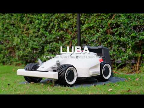
4.1 Wire-Free Setup and Virtual Boundaries
Let’s start with the biggest lifestyle upgrade: no more digging trenches.
If you’ve ever installed a traditional boundary wire, you know the pain—hours of burying cable, only to have it break later and send you back outside with a shovel. It’s the kind of “smart home” upgrade that somehow creates more work.
You simply guide the mower around your lawn once, and it records those coordinates with centimeter-level precision. That invisible fence becomes permanent—until you decide to change it.
- Want to expand a flower bed?
- Add a trampoline?
- Redesign your yard?
No problem. Just redraw the boundary. Done.
Because RTK maintains centimeter-level virtual boundary accuracy, the mower can follow edges just as reliably as a physical wire—without ever touching one.
4.2 Straight-Line Mowing and Professional Lawn Patterns
Now let’s talk about the part you actually see.
Older robot mowers move randomly—bouncing around like a Roomba on grass. They eventually cover everything, but the process is messy, inefficient, and honestly a little chaotic.
RTK changes that behavior entirely. With precise positioning, the mower can follow planned, parallel paths across your lawn. Think of it less like “wandering” and more like a farmer plowing a field—line by line, perfectly spaced.
Why does that matter?
- Less overlap → faster mowing
- No missed strips → consistent coverage
- Clean turns at boundaries → sharper edges
And then there’s the visual payoff: those crisp, alternating lawn stripes that used to require a professional crew.
You’ll literally see the difference after one cycle. Not “kind of cleaner.” Visibly better. It doesn’t just cut your grass. It patterns it.
4.3 Multi-Zone Navigation and Smart Lawn Management
Real yards aren’t perfect rectangles. They’re messy. Front yard. Backyard. Side strip. Maybe a narrow passage between fences. Add in trees, patios, and garden beds—and suddenly your “simple lawn” becomes a navigation puzzle.
This is where RTK quietly shines. Because the mower always knows its exact position, it can manage multiple zones as separate mapped areas. You can:
- Define different zones (front, back, side yard)
- Set schedules for each area
- Create corridors for moving between them
Picture this: the mower finishes your front yard in the morning, then navigates a narrow path to the backyard in the afternoon—without you lifting a finger.
Even battery management becomes smarter. It knows where it is, where it needs to go, and how to get back to charge before continuing.
It’s not just automation. It’s coordination.
5. Limitations of RTK (and Why Hybrid Systems Are Emerging)

5.1 Where RTK Struggles: Trees, Walls, and Signal Reflection
As powerful as RTK is, it’s not magic. And this is where expectations need a reality check. RTK depends on clear satellite signals. When those signals get blocked, scattered, or reflected, accuracy drops.
- Dense tree cover: signals weaken or scatter
- Tall walls or buildings: block satellite visibility
- Narrow passages: limited sky view reduces satellite connections
- Reflective surfaces: signals bounce, causing “multipath” errors
In these situations, the mower can lose its precise “fix” and fall back to lower accuracy. That’s when you might see hesitation, slight drifting, or even pauses. In extreme cases—like tight corridors between walls—it may struggle to navigate at all.
So while RTK feels flawless on open lawns, it can get unpredictable in cluttered environments. And that’s not a flaw in your mower—it’s a limitation of satellite physics.
5.2 Setup Sensitivity: Why Base Station Placement Matters So Much
Here’s the part most people underestimate: setup. You can buy the best RTK mower on the market—but if the base station is poorly placed, performance will suffer. Period.
The base station needs:
- A clear, wide view of the sky
- Minimal obstruction from trees or buildings
- Stable, elevated placement (roof or open yard is ideal)
Why? Because the base and mower must “see” the same satellites. If a wall blocks part of the sky for one but not the other, their data no longer aligns—and corrections break down.
This is why many experienced users end up mounting their base station higher than expected. It’s not overkill. It’s essential. Get this right, and everything feels seamless. Get it wrong, and nothing quite works the way it should.
5.3 RTK vs Vision, LiDAR, and VSLAM: Which Works Best?
So what happens when RTK struggles? That’s where other technologies step in. Let’s break it down simply:
| Technology | Core Strength |
|---|---|
| RTK | Knows exactly where it is (global positioning) |
| Vision (VSLAM) | Understands what it sees (edges, obstacles) |
| LiDAR | Maps surroundings using laser measurements |
Each has strengths—and weaknesses. RTK is unbeatable for open areas and absolute positioning. But it struggles when the sky is blocked. Vision systems, on the other hand, don’t care about satellites—but they depend on lighting and visual features. LiDAR is extremely precise locally, but adds cost and complexity.
That’s why modern mowers are moving toward hybrid systems. Instead of choosing one, they combine them:
- RTK handles large-scale positioning
- Vision or LiDAR fills in gaps near obstacles or under trees
As highlighted in industry developments, combining RTK with vision systems allows the mower to maintain accuracy even when satellite signals degrade—effectively covering each other’s blind spots.
The result? More reliable navigation. Fewer interruptions. Better real-world performance.
6. Conclusion: Is RTK the Future of Robot Lawn Mowing?
RTK has fundamentally changed what robot lawn mowers can do. It takes navigation from rough, unpredictable movement to precise, repeatable automation—turning your lawn into something that actually looks professionally maintained.
If your yard is open, with clear sky visibility, RTK is a game-changer. You get wire-free setup, perfect edges, and efficient, structured mowing patterns that save both time and effort.
But it’s not one-size-fits-all. Dense trees, tight corridors, and complex environments can still challenge pure RTK systems. That’s why hybrid approaches—combining RTK with vision or LiDAR—are quickly becoming the new standard.
So is RTK the future? Yes—but not alone.
The real future is smarter systems that combine multiple technologies to handle the messy reality of real yards.
FAQ
Q: What is the main advantage of RTK GPS over standard GPS?
A: While standard GPS has a margin of error of several meters, RTK GPS uses carrier-phase measurements and real-time corrections to achieve centimeter-level accuracy. This precision allows robot mowers to navigate without physical wires and create perfectly straight, parallel mowing patterns for a professional finish.
Q: Why does an RTK mower need a base station?
A: The base station acts as a fixed reference point. Since its position is known, it calculates satellite signal errors caused by atmospheric conditions and sends instant corrections to the mower. This team effort ensures the mower knows its exact location relative to your yard's boundaries.
Q: Can RTK robot mowers work under dense tree cover?
A: RTK technology requires a clear line of sight to satellites. Dense tree canopies, tall buildings, or narrow passages can block or reflect signals, causing the mower to lose precision. In these environments, hybrid systems that combine RTK with vision sensors or LiDAR are often more reliable.
Q: What are virtual boundaries in RTK mowing?
A: Virtual boundaries are digital perimeters set via a smartphone app instead of burying physical wires. Using high-precision GPS coordinates, the mower recognizes these invisible fences, allowing users to easily update the mowing area, add flower beds, or exclude obstacles without any digging.
Q: Does the base station need a special power source?
A: Most RTK base stations require a standard outdoor power outlet and must be mounted in a high, open location with a 360-degree view of the sky. This ensures it can maintain a stable connection with as many GNSS satellites as possible for maximum accuracy.